Static models fail in a dynamic environment. Our Geospatial MLOps service builds automated pipelines for continuous retraining and performance monitoring, ensuring your models evolve with new satellite passes, sensor data, and real-world events.
Service
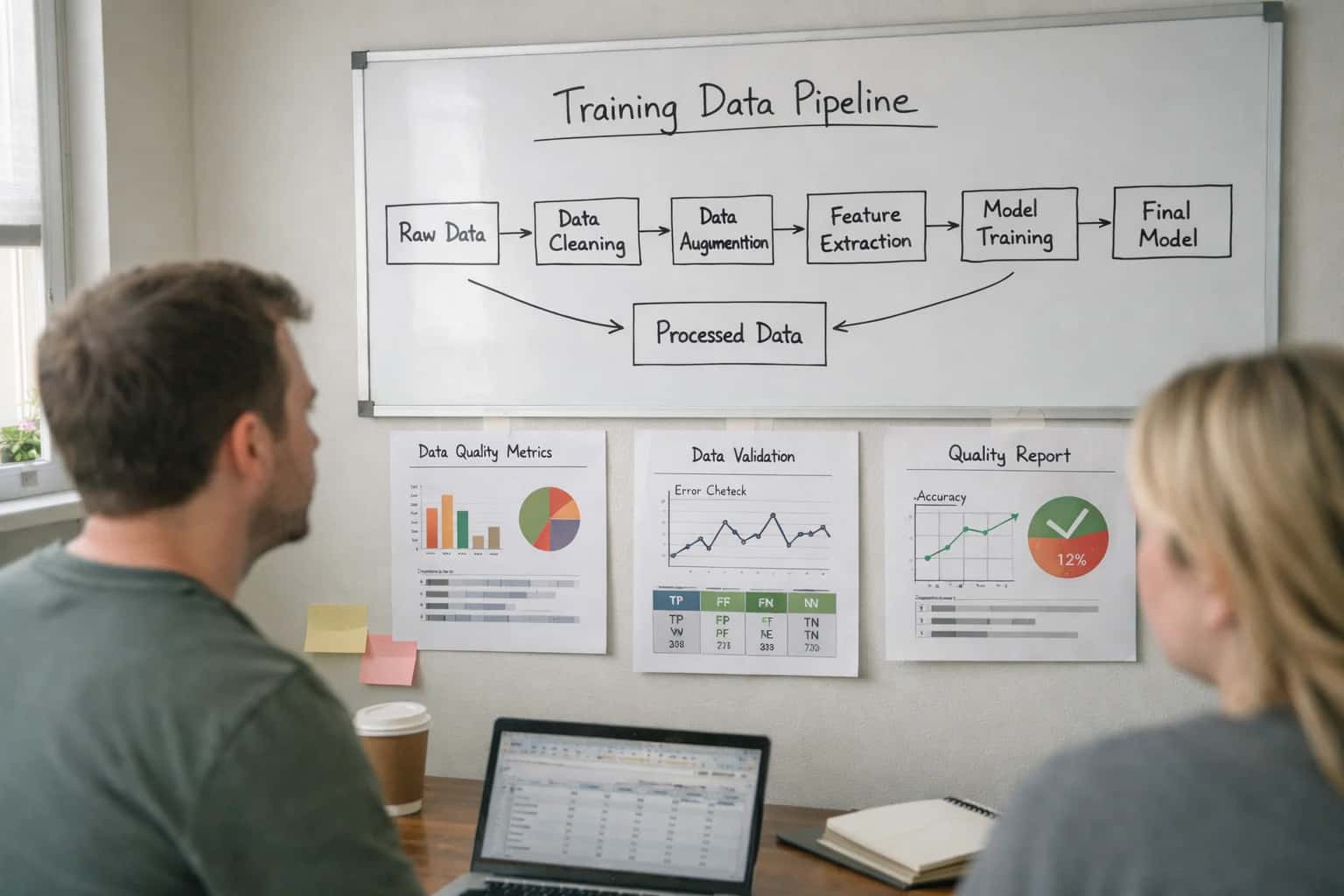
Geospatial MLOps and Lifecycle Management
We build continuous training and deployment pipelines for geospatial AI, automating retraining on new satellite imagery, versioning models and data, and monitoring performance in production to ensure your spatial intelligence remains accurate and actionable.
GEOAI MLOP
Your Geospatial AI Models Are Stale The Moment They're Deployed
Continuous training and deployment pipelines for geospatial AI that adapt to a changing world.
- Automated Retraining Triggers: Models retrain automatically on new
Sentinel-2imagery, fresh LiDAR scans, or when performance drifts below a99%accuracy threshold. - Version Control for Everything: Track every iteration of models, training datasets, and
GeoJSONlabels with full lineage for audit and rollback. - Production Monitoring Dashboards: Real-time tracking of inference latency, model drift across geographic tiles, and business KPIs like detection rates.
Move from manual, costly model updates to a self-improving spatial intelligence system. We engineer the full lifecycle so your AI remains accurate and actionable.
This foundational MLOps discipline supports advanced applications like our Planetary-scale Satellite Imagery AI Processing and is critical for building reliable Geospatial AI for Disaster Response and Management.
FROM PIPELINE TO PRODUCTION
Business Outcomes of Geospatial MLOps
Our Geospatial MLOps service delivers continuous, reliable AI for location intelligence. We build automated pipelines that turn raw satellite imagery and sensor data into actionable insights, ensuring your models perform accurately in production over time.
05
Faster Time-to-Insight
Reduce the cycle time from raw geospatial data to operational intelligence from months to weeks. Our automated MLOps pipelines for data validation, model training, and deployment eliminate manual bottlenecks, allowing your teams to iterate rapidly on new analysis tasks like disaster response mapping or urban sprawl detection.
< 4 weeks
To initial deployment
60% faster
Model iteration cycles
06
Reduced Operational Overhead
Shift from costly, manual model management to a fully automated lifecycle. Our managed pipelines handle data ingestion, preprocessing, training, and deployment, significantly reducing the engineering effort required to keep your geospatial AI systems running. This allows your data scientists to focus on innovation, not infrastructure.
Learn more about our approach to lifecycle management in our guide on Geospatial MLOps and Lifecycle Management.
70% reduction
In manual ops tasks
99.5%
Pipeline uptime SLA
Structured Delivery Framework
Geospatial MLOps Engagement Timeline
A phased approach to building and deploying robust, automated geospatial AI pipelines, from initial assessment to full production lifecycle management.
| Phase & Deliverables | Timeline | Key Outcomes |
|---|---|---|
Phase 1: Discovery & Architecture Design | 1-2 weeks | Technical requirements document, system architecture blueprint, and project roadmap |
Phase 2: Pipeline & Environment Setup | 2-3 weeks | Containerized training environment, CI/CD pipeline for models, and versioned data lake (e.g., DVC) |
Phase 3: Model Development & Validation | 3-5 weeks | Custom-trained object detection/segmentation model (e.g., SAM 2 fine-tuned), validation report against ground truth |
Phase 4: Deployment & Integration | 2-3 weeks | Model deployed to cloud/edge (e.g., Kubernetes), integrated with GIS (ArcGIS) or analytics platform, monitoring dashboard |
Phase 5: Automation & Lifecycle Enablement | 1-2 weeks | Automated retraining triggers, performance drift alerts, and full handover documentation |
Total Project Timeline | 9-15 weeks | Fully operational Geospatial MLOps platform with automated lifecycle management |
Ongoing Support & Scaling | Post-launch | Optional SLA for uptime, performance tuning, and scaling to new regions or data sources |
ENTERPRISE-GRADE GEOAI
Industries and Applications We Serve
Our Geospatial MLOps and Lifecycle Management services deliver production-ready AI pipelines for mission-critical spatial analytics. We build systems that scale from prototype to planetary-scale deployment, ensuring continuous model accuracy and operational reliability.
01
Defense & National Security Intelligence
Deploy secure, air-gapped geospatial AI pipelines for real-time object detection and change monitoring from satellite constellations. Our MLOps frameworks ensure model versioning and automated retraining on new intelligence, maintaining >99% precision for vehicle and vessel tracking.
Learn about our work in secure AI for defense in our Sovereign AI Infrastructure Development services.
>99%
Tracking Precision
< 100ms
Alert Latency
02
Climate & Environmental Monitoring
Build continuous training pipelines for AI models that monitor deforestation, glacial retreat, and coastal erosion. We implement automated retraining triggers on new Sentinel-2/Landsat imagery, ensuring models adapt to seasonal changes and provide auditable change detection reports.
Explore our dedicated Climate Risk Spatial Modeling Services for predictive analytics.
Petabyte-scale
Data Pipelines
Automated
Retraining Triggers
03
Smart Cities & Urban Infrastructure
Engineer lifecycle-managed AI for traffic flow optimization, infrastructure health assessment, and urban sprawl analysis. Our MLOps platforms version both models and training data (e.g., high-res aerial imagery), enabling reproducible analysis for long-term urban planning and digital twin integration.
See how we enable urban intelligence with Smart City Geospatial Infrastructure Planning.
24/7
Model Monitoring
CI/CD
for GeoAI
04
Agriculture & Precision Farming
Operationalize AI for crop health analysis, yield prediction, and irrigation management. We build robust pipelines that ingest multispectral drone and satellite data, automatically retrain models on new growth cycle data, and deploy updated models to edge devices for in-field analytics.
Our expertise in sensor fusion extends to Agri-Tech and Smart Farming AI Development.
Sub-meter
Analysis Accuracy
Edge-to-Cloud
Deployment
05
Energy & Utilities Management
Implement geospatial AI MLOps for predictive maintenance of linear assets (pipelines, power lines) and renewable energy site optimization. Our systems monitor model drift against new inspection imagery (drone/satellite) and trigger retraining to maintain >95% accuracy in anomaly detection, preventing costly failures.
>95%
Anomaly Detection
Proactive
Retraining
06
Logistics & Supply Chain Visibility
Develop automated systems for port activity monitoring, fleet tracking, and warehouse site analysis using geospatial computer vision. Our lifecycle management ensures models performing object detection on satellite/AIS data are continuously evaluated and updated, providing reliable, real-time logistics intelligence.
This integrates with broader Intelligent Supply Chain and Autonomous Replenishment solutions.
Real-time
Asset Tracking
Global Scale
Deployment
Enabling Efficiency, Speed & Accuracy
Intelligent Analysis, Decision & Execution
We build AI systems for teams that need search across company data, workflow automation across tools, or AI features inside products and internal software.
Talk to Us
Search across company data
Give teams answers from docs, tickets, runbooks, and product data with sources and permissions.
Useful when people spend too long searching or get different answers from different systems.
Enterprise searchRAGPermissions
Read more
Automate internal workflows
Use AI to route work, draft outputs, trigger actions, and keep approvals and logs in place.
Useful when repetitive work moves across multiple tools and teams.
AI agentsWorkflow automationGovernance
Read more
Add AI to products and internal tools
Build assistants, guided actions, or decision support into the software your team or customers already use.
Useful when AI needs to be part of the product, not a separate tool.
AI integrationDecision supportModel routing
Read moreExpert Answers for Technical Leaders
Frequently Asked Questions on Geospatial MLOps
Get clear, specific answers to the most common questions CTOs and engineering leads ask when evaluating Geospatial MLOps partners. We focus on timelines, security, and measurable outcomes.
Our standard Geospatial MLOps pipeline deployment takes 2-4 weeks from kickoff to a production-ready Minimum Viable Pipeline (MVP). This includes initial environment setup, pipeline architecture, and integration with one core data source (e.g., a satellite imagery feed). Complex multi-source systems with real-time Edge AI for Real-time Spatial Analytics can extend to 6-8 weeks. We provide a detailed project plan with weekly milestones during scoping.

About the author
Prasad Kumkar
CEO & MD, Inference Systems
Prasad Kumkar is the CEO & MD of Inference Systems and writes about AI systems architecture, LLM infrastructure, model serving, evaluation, and production deployment. Over 5+ years, he has worked across computer vision models, L5 autonomous vehicle systems, and LLM research, with a focus on taking complex AI ideas into real-world engineering systems.
His work and writing cover AI systems, large language models, AI agents, multimodal systems, autonomous systems, inference optimization, RAG, evaluation, and production AI engineering.
LinkedIn
Limited slotsGet a Free AI Consultation
Partnered with leading AI, data, and software stack.


How We Work
Custom AI workflows for your Business
One-fit-all AI don't work for modern businesses. At Inferensys, we aim to understand your business & custom requirements; which we use to define most efficient agentic workflows, the data, and the tools for your business.
01
Review the use case
We understand the task, the users, and where AI can actually help.
Read more02
Pick the right approach
We define what needs search, automation, or product integration.
Read more03
Build the first useful version
We implement the part that proves the value first.
Read more04
Improve from there
We add the checks and visibility needed to keep it useful.
Read moreThe first call is a practical review of your use case and the right next step.
Talk to Us