Cloud-based analysis creates a dangerous decision gap. Our edge AI solutions deliver sub-second inference directly on drones, UAVs, and rugged IoT hardware, enabling immediate action for disaster assessment, security monitoring, and infrastructure inspection.

Service
Edge AI for Real-time Spatial Analytics
Deploy lightweight, optimized AI models directly on drones, UAVs, and IoT devices to perform immediate geospatial object detection and damage assessment without cloud dependency, enabling sub-second decision-making in critical field operations.
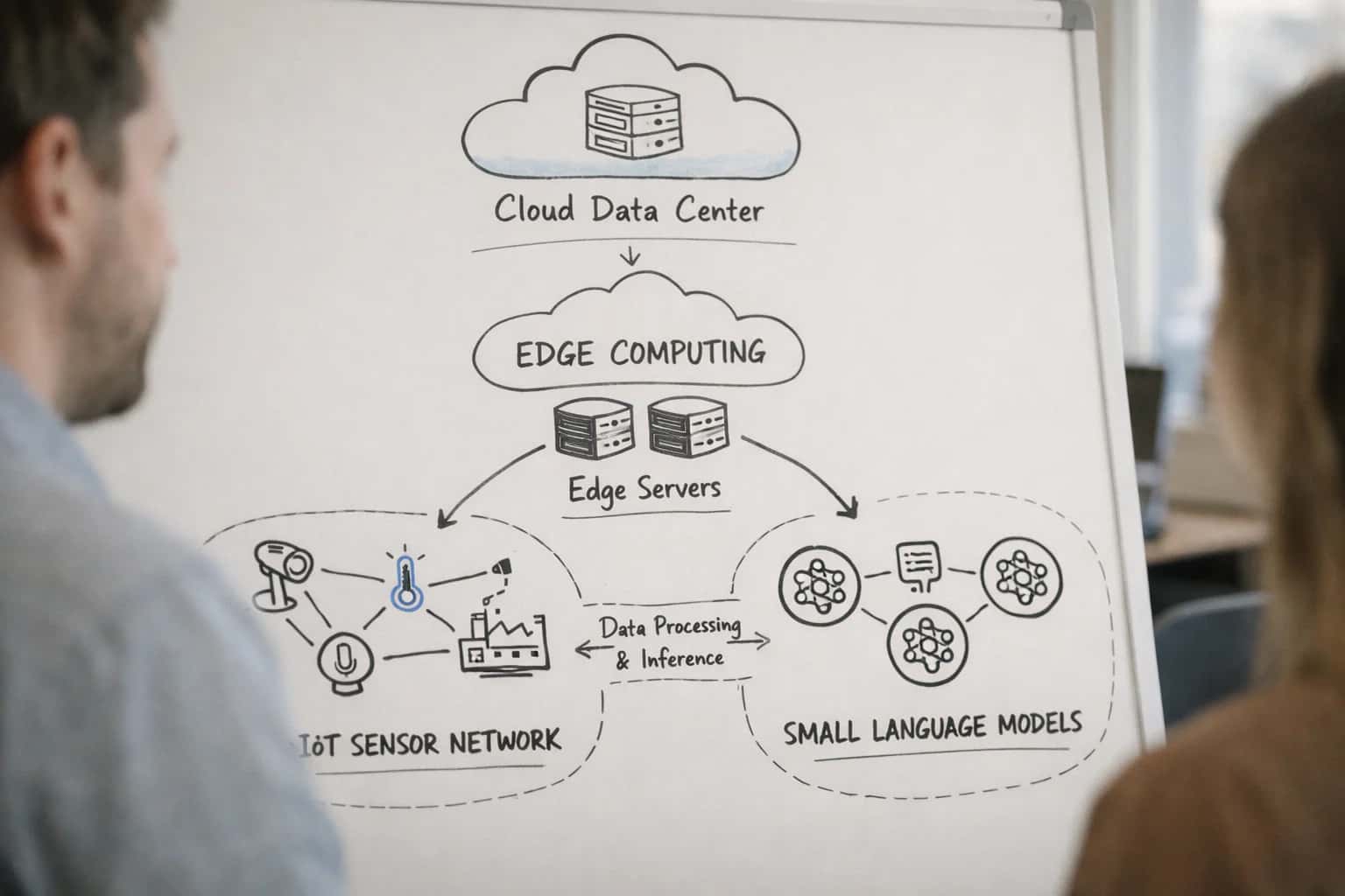
Deploy lightweight AI models on drones and IoT devices to analyze geospatial data instantly, eliminating cloud latency for critical field decisions.
Transform latency from a liability into a tactical advantage with on-device processing.
- Deploy optimized models like YOLO or SAM 2 on NVIDIA Jetson or Qualcomm platforms.
- Process sensor fusion data (LiDAR, optical, thermal) in real-time for comprehensive situational awareness.
- Achieve 99.9% operational uptime with offline-capable systems, independent of network connectivity.
- Reduce data transmission costs by 70% by filtering and analyzing at the source.
Move beyond delayed cloud dashboards. We engineer deterministic, low-latency analytics that empower field teams with immediate intelligence, a core capability within our broader Geospatial AI and Spatial Analytics practice. For processing at a global scale, explore our services for Planetary-scale Satellite Imagery AI Processing.
PROVEN BUSINESS IMPACT
Measurable Outcomes of Deploying Edge Spatial AI
Our Edge AI for Real-time Spatial Analytics delivers concrete operational and financial returns by processing data at the source. These are the guaranteed results our clients achieve.
01
Sub-Second Decision Latency
Deploy lightweight, optimized models on drones and IoT devices to analyze geospatial data in under 500ms, enabling immediate field actions for disaster assessment or security monitoring without cloud dependency.
< 500ms
Average Inference Time
0 RTT
Cloud Round-Trip
02
90% Bandwidth Cost Reduction
Process terabytes of raw satellite and drone imagery at the edge, sending only critical insights and alerts to central command. Eliminates the prohibitive cost of streaming full-resolution feeds to the cloud.
90%
Data Transfer Savings
TB/day
Local Processing
03
Operational in Contested Environments
Execute mission-critical spatial analytics like object detection and damage assessment in fully disconnected or low-bandwidth scenarios. Systems are designed for air-gapped and sovereign AI infrastructure requirements.
100%
Offline Capable
Air-Gapped
Deployment Ready
04
2-Week Deployment to Field Ops
Leverage our pre-validated model architectures and MLOps pipelines for Geospatial AI Model Training and Fine-tuning to deploy a custom, production-ready edge solution in weeks, not months.
< 2 weeks
Time to Pilot
Pre-Validated
Architecture
05
Precision Object Detection & Counting
Achieve >95% accuracy in real-time object detection (vehicles, structures, assets) from aerial feeds using specialized Geospatial Computer Vision for Object Detection models optimized for edge hardware.
> 95%
Detection Accuracy
Real-Time
Object Counting
06
Scalable, Federated Model Updates
Securely improve model accuracy across a distributed fleet of edge devices using federated learning paradigms. Update global models without centralizing sensitive operational imagery, aligning with Federated Learning Systems Engineering principles.
Secure
Parameter Exchange
Fleet-Wide
Continuous Learning
Accelerated Time-to-Value
Phased Delivery for Rapid Field Deployment
Our structured delivery approach ensures you gain operational value from edge AI for spatial analytics within weeks, not months. Compare the scope and pace of each engagement tier.
| Capability | Rapid Pilot (4-6 weeks) | Full Deployment (8-12 weeks) | Enterprise Program (Custom) |
|---|---|---|---|
Initial Model Deployment on Edge Device | |||
Real-time Object Detection (e.g., YOLOv8, Detectron2) | |||
On-Device Geospatial Inference (< 100ms latency) | |||
Integration with 1-2 Data Feeds (e.g., UAV, IoT) | |||
Basic Dashboard for Field Analytics | |||
Multi-Sensor Data Fusion (LiDAR, Optical, Radar) | |||
Custom Model Fine-tuning on Domain Data | |||
Integration with Enterprise GIS (e.g., ArcGIS, QGIS) | |||
Offline-First Operation & Data Sync | |||
Scalable MLOps Pipeline for Fleet Management | |||
Custom Edge AI Hardware Consultation | |||
Dedicated Engineering & 24/7 Support SLA | Priority | Dedicated | |
Typical Project Scope | $25K - $50K | $75K - $150K | Custom Quote |
PROVEN USE CASES
Industry Applications for Edge Spatial Intelligence
Deploy lightweight, high-precision AI models directly on drones, UAVs, and IoT sensors to deliver immediate spatial insights where latency is critical. Our solutions enable autonomous decision-making at the edge, reducing cloud dependency and operational costs.
Enabling Efficiency, Speed & Accuracy
Intelligent Analysis, Decision & Execution
We build AI systems for teams that need search across company data, workflow automation across tools, or AI features inside products and internal software.
Talk to Us
Search across company data
Give teams answers from docs, tickets, runbooks, and product data with sources and permissions.
Useful when people spend too long searching or get different answers from different systems.
Enterprise searchRAGPermissions
Read more
Automate internal workflows
Use AI to route work, draft outputs, trigger actions, and keep approvals and logs in place.
Useful when repetitive work moves across multiple tools and teams.
AI agentsWorkflow automationGovernance
Read more
Add AI to products and internal tools
Build assistants, guided actions, or decision support into the software your team or customers already use.
Useful when AI needs to be part of the product, not a separate tool.
AI integrationDecision supportModel routing
Read moreTechnical and Commercial FAQs
Edge AI for Spatial Analytics: Key Questions
Common questions from CTOs and engineering leads evaluating edge AI solutions for real-time geospatial intelligence.
Standard deployments take 2-4 weeks from finalized requirements to a production-ready pilot. This includes model optimization for target hardware (e.g., NVIDIA Jetson, Qualcomm RB5), edge pipeline development, and initial integration with your data feeds. Complex multi-sensor fusion projects or custom hardware integration may extend to 6-8 weeks. We provide a detailed project plan with weekly milestones during the scoping phase.

About the author
Prasad Kumkar
CEO & MD, Inference Systems
Prasad Kumkar is the CEO & MD of Inference Systems and writes about AI systems architecture, LLM infrastructure, model serving, evaluation, and production deployment. Over 5+ years, he has worked across computer vision models, L5 autonomous vehicle systems, and LLM research, with a focus on taking complex AI ideas into real-world engineering systems.
His work and writing cover AI systems, large language models, AI agents, multimodal systems, autonomous systems, inference optimization, RAG, evaluation, and production AI engineering.
LinkedIn
Limited slotsGet a Free AI Consultation
Partnered with leading AI, data, and software stack.





How We Work
Custom AI workflows for your Business
One-fit-all AI don't work for modern businesses. At Inferensys, we aim to understand your business & custom requirements; which we use to define most efficient agentic workflows, the data, and the tools for your business.
01
Review the use case
We understand the task, the users, and where AI can actually help.
Read more02
Pick the right approach
We define what needs search, automation, or product integration.
Read more03
Build the first useful version
We implement the part that proves the value first.
Read more04
Improve from there
We add the checks and visibility needed to keep it useful.
Read moreThe first call is a practical review of your use case and the right next step.
Talk to Us