Integrating AI into Granular's yield workflow means connecting to specific data objects and surfaces: the Yield Map module for spatial data ingestion, the Field Records system for historical context, and the Management Zones builder for prescription outputs. The primary integration points are Granular's REST APIs for pulling as-applied/harvest data and pushing zone-based recommendations, and its webhook system for triggering automated analyses when new yield data is finalized. This creates a closed-loop system where AI doesn't just analyze—it directly informs the next season's plan within the same platform.
Integration
AI Integration with Granular Yield Analysis
A technical guide for integrating deep learning models with Granular's yield map data to automate management zone identification, correlate yield-influencing factors, and generate data-driven recommendations for future crop planning.
ARCHITECTURE BLUEPRINT
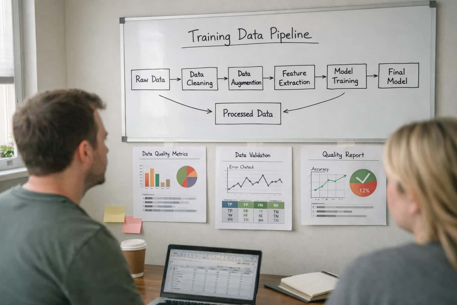
Where AI Fits into Granular's Yield Workflow
A technical guide to embedding AI agents and predictive models directly into Granular's yield analysis and management cycle.
A practical implementation flows through three stages: First, an AI agent monitors for new yield map uploads via webhook. It then retrieves the raw spatial data (e.g., shapefiles, yield-by-point) and enriches it with correlated field records on hybrids, inputs, and weather from Granular's data cloud. Using deep learning models trained on similar operations, the agent identifies yield stability zones, pinpoints underperforming areas, and correlates drivers like soil type, drainage, or input timing. Finally, it generates updated Management Zone geometries and variable-rate seeding or nutrient prescriptions, posting them back to Granular as draft recommendations for agronomist review.
Rollout focuses on augmenting, not replacing, expert judgment. AI-generated zones and insights appear as a new layer within the Granular interface, flagged for review. Governance is managed through Granular's existing user roles and permissions; for example, only farm managers or certified agronomists can approve an AI-generated prescription for export to equipment. This human-in-the-loop model ensures control while turning a multi-day manual analysis process into a same-day, data-grounded starting point. The result is a shift from reactive yield explanation to proactive, prescriptive planning for the next crop cycle.
YIELD ANALYSIS WORKFLOWS
Key Integration Surfaces in Granular
Connecting Raw Yield Data to AI Models
Granular's platform ingests yield monitor data from combines, but raw files often require cleaning and normalization before analysis. AI integration surfaces here to automate data validation, outlier detection, and unit conversion.
Key integration points include:
- File Import APIs: Programmatically push cleaned, structured yield data (as GeoJSON or shapefiles) into Granular's mapping layers.
- Data Validation Webhooks: Trigger AI quality checks on newly uploaded yield maps to flag potential sensor errors or calibration issues before they affect analysis.
- Historical Data Lake: Access multi-year yield records via Granular's data APIs to train and ground forecasting models, ensuring predictions are farm-specific.
A typical implementation uses a middleware service that listens for new yield data, runs it through an AI preprocessing pipeline, and posts the enriched, validated layer back to the correct field record in Granular.
GRANULAR YIELD MAP INTEGRATION
High-Value AI Use Cases for Yield Analysis
Yield maps are rich with spatial data, but turning that data into actionable insights is often a manual, time-consuming process. Integrating AI directly with Granular's yield analysis modules automates pattern detection, correlates drivers, and generates prescriptive guidance for the next season.
01
Automated Management Zone Delineation
AI analyzes yield map variability, soil electrical conductivity, and elevation data to automatically define and update management zones within Granular. This replaces manual GIS work, creating data-driven zones for variable rate seeding and input application that update annually.
Hours -> Minutes
Zone creation
02
Yield Driver Correlation Analysis
An AI agent cross-references yield data with dozens of potential drivers—soil test results, weather events, hybrid selection, application timing—stored in Granular. It identifies statistically significant correlations and ranks factors by impact, providing a clear narrative on what influenced performance.
1 sprint
vs. manual analysis
03
Anomaly & Boundary Effect Detection
Computer vision models scan yield maps to automatically flag spatial anomalies like drainage issues, compaction streaks, or sprayer skips. The AI logs these as geo-tagged issues in Granular's field notes and can trigger work orders for investigation or remediation.
Batch -> Real-time
Issue detection
04
Predictive Yield Gap Analysis
Using historical yield maps, weather, and management records, AI models calculate a field-specific potential yield. The system compares actual results to this benchmark within Granular, quantifying the yield gap and simulating the economic impact of closing it with different practice changes.
05
Prescription Generation for Next Season
Based on zone delineation and driver analysis, the AI generates data-grounded variable rate prescriptions for seeding population, nitrogen, and P/K. These prescriptions are formatted as ready-to-import files for Granular's planning modules or directly for compatible equipment controllers.
Same day
Post-harvest planning
06
Multi-Year Trend & Stability Mapping
AI stacks 3-5 years of yield maps, normalizing for weather, to produce stability maps showing consistently high/low performing areas. This long-term view, surfaced in Granular, helps prioritize capital investments in drainage, tile, or soil amendments on the most stable opportunities.
FROM DATA TO DECISION
Example AI-Powered Yield Analysis Workflows
These workflows illustrate how to connect AI models to Granular's yield map data and analytics modules, automating the transformation of raw spatial data into actionable agronomic and financial insights for the next season.
Trigger: A new yield map file is uploaded to a field record in Granular.
Workflow:
- A webhook from Granular triggers an AI pipeline, passing the field ID and file location.
- The pipeline ingests the raw yield data (e.g., shapefile, CSV), cleans it, and normalizes values.
- A computer vision model analyzes the spatial patterns to detect anomalies caused by equipment errors (e.g., header bounce, GPS drift, sudden stops) and flags them for review or automatic filtering.
- A clustering algorithm (e.g., k-means, DBSCAN) processes the cleaned data to identify stable yield zones, moving beyond simple percentile-based maps.
- The refined management zones, anomaly report, and confidence scores are posted back to Granular via its API, creating new spatial layers and attaching a summary note to the field's activity log.
Human Review Point: The agronomist reviews the AI-generated zones and anomaly report in Granular before approving them for use in planning.
FROM YIELD MAPS TO ACTIONABLE ZONES
Implementation Architecture: Data Flow & Model Layer
A production-ready blueprint for connecting AI models to Granular's yield analysis workflows, turning raw spatial data into structured, season-over-season intelligence.
The integration connects at two primary layers within Granular: the Field Data API for ingesting raw yield map files (e.g., shapefiles, ISOXML) and the Management Zones module where AI-generated prescriptions are written back. An orchestration service, typically deployed as a containerized microservice, handles the pipeline: it listens for new yield data uploads via webhook, extracts spatial and as-applied data, and submits it to a dedicated AI inference endpoint. The AI layer itself is a multi-model stack, where a convolutional neural network (CNN) performs initial spatial pattern recognition on yield heatmaps, and a downstream tree-based model correlates those patterns with contextual data pulled from Granular's records—soil type, hybrid, planting population, and applied inputs—to identify the primary yield-limiting drivers for each zone.
Outputs are structured as new zone boundaries with attached metadata: a confidence score, the top three correlated drivers (e.g., soil_compaction, nitrogen_timing, hybrid_suitability), and a vector of feature importance. This payload is written back to Granular via the Management Zones API, creating or updating zones within the correct field and season. For traceability, each AI-generated zone includes a lineage tag in its properties linking it to the source yield file and model version. The most critical governance step is a human-in-the-loop approval workflow; new zones are created in a draft status, triggering a notification for the agronomist or farm manager to review, adjust boundaries, and approve before they become active in planning tools.
Rollout follows a phased, field-by-field approach. We start with a pilot on historical data from 2-3 representative fields to validate model accuracy against known outcomes, tuning the driver correlation logic for the operation's specific data maturity. In production, the service scales by processing yield data as it's harvested, ensuring zones are ready for post-season review and next-season planning. The entire architecture is designed for iterative learning; as approved zones and their subsequent season results are recorded back in Granular, this feedback loop is used to retrain and improve the correlation models annually, turning the integration into a continuously learning system. For teams managing this, we provide a companion dashboard on /integrations/farm-management-platforms/ai-governance-dashboards to monitor model performance, data quality, and user adoption rates.
INTEGRATION PATTERNS
Code & Payload Examples
Ingesting and Structuring Raw Yield Data
Granular's yield analysis typically starts with raw yield monitor files (e.g., .csv, .dat). An AI integration pipeline must first ingest, clean, and georeference this data before analysis. The following Python example demonstrates a robust ingestion pattern using a hypothetical Granular API endpoint for uploading processed data.
pythonimport pandas as pd import geopandas as gpd from shapely.geometry import Point import requests # 1. Load raw yield monitor data yield_df = pd.read_csv('field_123_yield_2024.csv') # 2. Clean and standardize columns (common across monitors) yield_df_clean = ( yield_df.rename(columns={ 'Lon': 'longitude', 'Lat': 'latitude', 'Yld_Vol_Dr': 'yield_mass_kg', 'Moist': 'moisture_pct', 'Speed': 'speed_mph' }) .dropna(subset=['longitude', 'latitude', 'yield_mass_kg']) ) # 3. Convert to GeoDataFrame for spatial operations gdf = gpd.GeoDataFrame( yield_df_clean, geometry=gpd.points_from_xy(yield_df_clean.longitude, yield_df_clean.latitude), crs='EPSG:4326' ) # 4. Aggregate to a standard grid (e.g., 10m x 10m) for analysis grid = gdf.sjoin(gdf.buffer(10).envelope) # Simplified aggregation logic aggregated_yield = grid.groupby('geometry').agg({ 'yield_mass_kg': 'mean', 'moisture_pct': 'mean', 'speed_mph': 'mean' }).reset_index() # 5. Prepare payload for Granular's Yield Map API payload = { "field_id": "FLD-2024-789", "season": "2024", "crop": "Corn", "yield_units": "kg/ha", "data_points": aggregated_yield.to_dict('records') # List of geojson-like features } # 6. Post to Granular's internal API (example endpoint) # response = requests.post( # 'https://api.granular.ag/v1/fields/yield-maps', # json=payload, # headers={'Authorization': 'Bearer YOUR_API_KEY'} # )
This pipeline ensures AI models receive clean, structured, and spatially-aware yield data as a foundation for zone analysis.
AI-POWERED YIELD ANALYSIS
Realistic Time Savings & Operational Impact
How integrating deep learning models with Granular's yield map data transforms analysis from a post-season review into a proactive planning tool.
| Workflow | Before AI | After AI | Implementation Notes |
|---|---|---|---|
Yield Map Anomaly Detection | Manual visual review of maps across 100+ fields | Automated flagging of low-yield zones with probable causes | AI scans uploaded shapefiles/rasters; agronomist reviews flagged zones |
Management Zone Refinement | Static zones based on soil type; updated every 3-5 years | Dynamic zones updated annually using yield + satellite correlation | Integrates with Granular's 'Fields' API; zones feed into VRT planning |
Yield Driver Correlation Analysis | Spreadsheet analysis of 5-6 variables per field | Automated analysis of 20+ variables (soil, weather, inputs, hybrid) | AI model runs on consolidated Granular data; outputs to 'Insights' module |
Preseason Planning Report Generation | 2-3 days to compile data and write recommendations | Draft report generated in 1-2 hours for agronomist refinement | Leverages Granular's reporting engine; AI writes narrative for key findings |
Multi-Year Trend Identification | Manual comparison of yield maps from previous seasons | Automated tracking of zone performance trends and soil health signals | Requires historical data sync; outputs visual trends to Granular dashboards |
As-Planted vs. As-Harvested Reconciliation | Post-harvest manual check for planter/sensor drift | Near-real-time flagging of significant deviations during harvest | Compares planting records from Granular to yield monitor data streams |
Scouting Priority & Task Generation | Reactive scouting based on grower calls or obvious issues | Proactive task list generated for top 3 anomaly zones per farm | AI creates tasks in Granular's 'Activities'; linked to yield map evidence |
IMPLEMENTING AI IN PRODUCTION
Governance, Security & Phased Rollout
A practical approach to deploying AI for yield analysis that respects data sovereignty, maintains auditability, and delivers incremental value.
A production AI integration with Granular must operate within the platform's existing data governance and security model. This means:
- API-first, read-only analysis: AI models consume data via Granular's secure APIs (e.g., Field, Yield Map, Operation records) without writing directly to core production tables. Insights and zone recommendations are staged in a separate
AI_Recommendationsobject or data mart, pending agronomist review. - Data residency and PII handling: Yield map data, often tied to specific fields and operations, is processed in a dedicated, compliant environment. We architect pipelines that strip or tokenize any personally identifiable information before model inference, keeping sensitive geospatial and operational data within your designated cloud region.
- Audit trails for every prediction: Each AI-generated management zone or yield driver correlation is logged with a complete lineage: source data snapshot, model version, prompt/parameters used, and the user who approved it. This creates a defensible record for quality control and regulatory compliance.
A phased rollout minimizes risk and builds user trust. A typical implementation progresses through three environments:
- Sandbox Analysis: Connect to a historical dataset or a non-production Granular tenant. Run models offline to generate baseline accuracy metrics and refine prompts against known outcomes. No live users.
- Pilot with Key Agronomists: Enable the integration for a small group of power users on a subset of fields. AI-generated zones appear as "draft" layers in Granular's mapping interface, clearly labeled and requiring manual approval before becoming active. Gather feedback on usability and recommendation relevance.
- Controlled Production Rollout: Gradually expand access by region, crop, or user role. Implement guardrails like confidence score thresholds (e.g., only auto-suggest zones where model confidence >85%) and mandatory human review for high-value decisions. Use Granular's existing role-based access control (RBAC) to manage who can view, approve, or override AI insights.
Governance is ongoing, not a one-time setup. We establish a lightweight review board—typically involving the head agronomist, data manager, and farm ops lead—to meet quarterly. This group reviews:
- Model performance drift: Are zone boundary predictions remaining accurate as new yield data comes in?
- Business impact: Are the correlated yield drivers (e.g., soil pH, planting population, weather events) leading to actionable input changes?
- User adoption & feedback: Are agronomists saving time? Are they trusting the suggestions?
This iterative process ensures the AI integration evolves from a novel analysis tool into a reliable component of the annual planning workflow, directly within the Granular platform where decisions are already made.
Enabling Efficiency, Speed & Accuracy
Intelligent Analysis, Decision & Execution
We build AI systems for teams that need search across company data, workflow automation across tools, or AI features inside products and internal software.
Talk to Us
Search across company data
Give teams answers from docs, tickets, runbooks, and product data with sources and permissions.
Useful when people spend too long searching or get different answers from different systems.
Enterprise searchRAGPermissions
Read more
Automate internal workflows
Use AI to route work, draft outputs, trigger actions, and keep approvals and logs in place.
Useful when repetitive work moves across multiple tools and teams.
AI agentsWorkflow automationGovernance
Read more
Add AI to products and internal tools
Build assistants, guided actions, or decision support into the software your team or customers already use.
Useful when AI needs to be part of the product, not a separate tool.
AI integrationDecision supportModel routing
Read moreIMPLEMENTATION AND WORKFLOW
Frequently Asked Questions
Common technical and operational questions about integrating deep learning models with Granular's yield analysis and management zone features.
The integration uses Granular's APIs to securely access yield map layers and associated field metadata. The typical data flow is:
- Trigger: A new yield map is uploaded and processed within Granular.
- Data Pull: Our integration service calls the Granular API to retrieve the yield map file (often in shapefile or GeoJSON format) along with key context like hybrid, field boundaries, and harvest date.
- Processing: The raw yield data is cleaned and normalized (e.g., removing outliers, converting to standardized units).
- AI Analysis: A deep learning model analyzes the spatial patterns to identify stable yield zones, classify low/high performing areas, and flag potential data anomalies.
- System Update: The resulting management zone polygons and analysis metadata are pushed back into Granular via API, creating new layers or enriching existing field records for use in planning modules.
All data transfers are encrypted, and API credentials are managed via a secure secrets vault, adhering to Granular's data governance policies.

About the author
Prasad Kumkar
CEO & MD, Inference Systems
Prasad Kumkar is the CEO & MD of Inference Systems and writes about AI systems architecture, LLM infrastructure, model serving, evaluation, and production deployment. Over 5+ years, he has worked across computer vision models, L5 autonomous vehicle systems, and LLM research, with a focus on taking complex AI ideas into real-world engineering systems.
His work and writing cover AI systems, large language models, AI agents, multimodal systems, autonomous systems, inference optimization, RAG, evaluation, and production AI engineering.
LinkedIn
Limited slotsGet a Free AI Consultation
Partnered with leading AI, data, and software stack.


How We Work
Custom AI workflows for your Business
One-fit-all AI don't work for modern businesses. At Inferensys, we aim to understand your business & custom requirements; which we use to define most efficient agentic workflows, the data, and the tools for your business.
01
Review the use case
We understand the task, the users, and where AI can actually help.
Read more02
Pick the right approach
We define what needs search, automation, or product integration.
Read more03
Build the first useful version
We implement the part that proves the value first.
Read more04
Improve from there
We add the checks and visibility needed to keep it useful.
Read moreThe first call is a practical review of your use case and the right next step.
Talk to Us