The integration point is Trimble Ag's satellite imagery ingestion pipeline, typically fed by third-party providers like Planet, Sentinel, or Trimble's own Connect Farm imagery services. AI models are injected as a processing layer between raw imagery delivery and the generation of actionable NDVI, NDRE, or other vegetative index maps in the Connected Farm platform. This layer performs pixel-level analysis to classify issues (e.g., water stress, nutrient deficiency, pest damage) and temporal analysis to flag significant changes between successive captures, transforming raw spectral data into structured, labeled alerts.
Integration
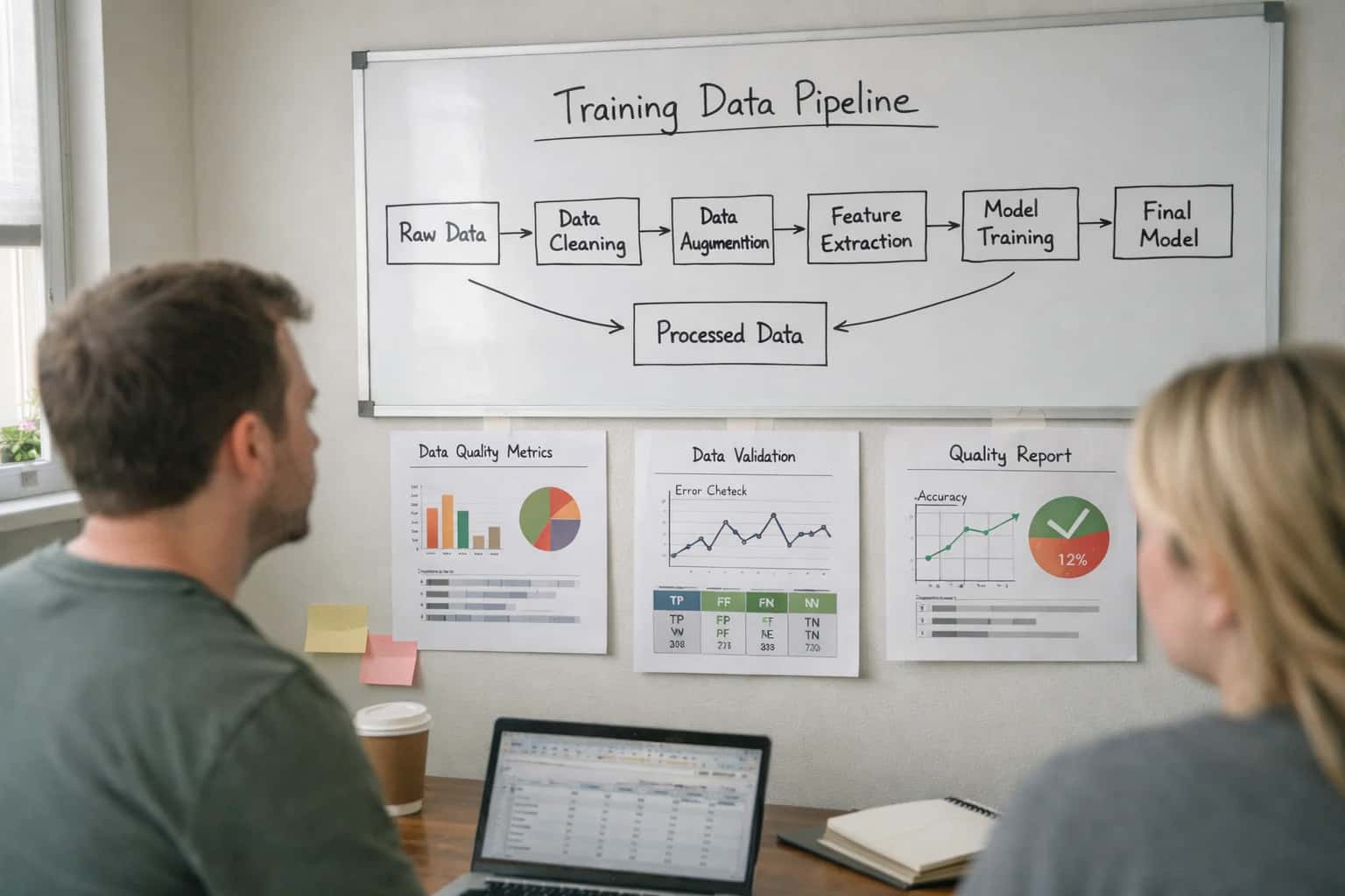
AI Integration for Trimble Ag Satellite Imagery
Technical guide for building automated AI pipelines that process Trimble's satellite and NDVI data for crop health scoring, change detection, and actionable field alerts.
ARCHITECTURE FOR AUTOMATED CROP INTELLIGENCE
Where AI Fits in the Trimble Ag Satellite Imagery Pipeline
A technical blueprint for integrating AI models into Trimble Ag's satellite and NDVI data pipeline to automate crop health scoring and change detection.
Implementation involves deploying containerized AI models (e.g., computer vision for anomaly detection, time-series models for trend analysis) that subscribe to new imagery events via a message queue. Each processed scene generates a structured JSON payload containing georeferenced anomaly polygons, confidence scores, and suggested issue codes. This payload is posted to a Trimble Ag REST API endpoint (or written to a shared cloud storage location defined in their integration spec) to create new Scouting Tasks, update Field Health layers, or trigger Work Order drafts in the operational plan. Critical governance includes model versioning, confidence threshold configuration per crop type, and a human-in-the-loop review step for low-confidence detections before task creation.
Rollout is phased, starting with a single vegetative index (e.g., NDVI) and crop type to calibrate model performance against ground-truth scouting reports. The AI pipeline's outputs are initially surfaced in a dedicated "AI Insights" dashboard layer within Trimble Ag, allowing agronomists to validate and adjust before full automation. This approach de-risks integration, builds trust in the AI's recommendations, and provides clear audit trails comparing AI-detected issues versus human-confirmed ones, ensuring the system enhances—rather than disrupts—existing precision ag workflows.
SATELLITE IMAGERY PIPELINE
Integration Surfaces Within Trimble Ag
Connecting Third-Party & Proprietary Feeds
The first integration surface is the data ingestion layer, where satellite imagery from providers like Planet, Sentinel Hub, or Trimble's own AgDNA network enters the platform. AI integration here focuses on automating and enhancing the data pipeline.
Key Integration Points:
- Webhook Listeners: Configure endpoints to receive push notifications from satellite providers when new imagery (e.g., NDVI, EVI, thermal) is available for a registered field boundary.
- API-Based Pull: Schedule automated calls to provider APIs (e.g., Planet's Orders API) to fetch imagery for specific fields based on crop stage or a predefined monitoring schedule.
- Data Harmonization: Use lightweight AI models to normalize disparate data formats, align coordinate reference systems, and fill small data gaps via inpainting, creating a clean, analysis-ready raster stack for each field and date.
This stage ensures a reliable, automated flow of raw imagery into Trimble Ag's data lake, ready for downstream AI processing.
TRIMBLE AG INTEGRATION PATTERNS
High-Value AI Use Cases for Satellite Imagery
Transform raw satellite and NDVI data into automated insights within Trimble Ag's Connected Farm platform. These AI-powered workflows connect directly to field records, tasking modules, and scouting logs to reduce manual analysis and accelerate decision cycles.
01
Automated Crop Health Scoring
AI models process daily or weekly NDVI, NDRE, and other spectral indices from Trimble's satellite feeds to generate per-field health scores. Workflow: Scores trigger automated alerts in the field monitoring dashboard and can create scouting tasks in the task management module for areas below threshold.
Batch -> Real-time
Analysis cadence
02
Change Detection for Anomaly Alerts
Continuously compare new imagery against a baseline to detect unexpected changes—like water stress, nutrient deficiency, or pest damage—sooner than manual review. Integration: Alerts are posted as geotagged issues in Trimble's field logs, linked to the specific imagery layer for visual confirmation.
Same day
Issue identification
03
Prescription Zone Refinement
Use high-resolution satellite data to dynamically update management zones for variable rate seeding, fertilizer, or crop protection applications. Pattern: AI analyzes multi-temporal imagery to refine zone boundaries, which are then pushed via API to Trimble's VRT (Variable Rate Technology) modules for prescription generation.
04
Harvest Readiness & Logistics Planning
Predict crop maturity and optimal harvest windows by analyzing spectral signatures correlated with dry-down and quality. Workflow: Predictions feed into Trimble's harvest planning and logistics tools, helping schedule crews, equipment, and storage allocation across the operation.
1 sprint
Planning lead time gained
05
Cover Crop & Tillage Verification
Automatically verify practice implementation for sustainability programs (e.g., carbon, regen ag) by detecting cover crop emergence and tillage events from seasonal imagery stacks. Integration: AI-generated verification reports are attached to the corresponding field records in Trimble, ready for auditor review or program submission.
06
Yield Estimation & Anomaly Explanation
Combine pre-harvest satellite imagery with historical yield data to generate in-season yield estimates. Advanced pattern: For areas with predicted low yield, the AI cross-references imagery timelines with weather and application records to suggest probable causes (e.g., late planting, waterlogging) within the insights dashboard.
TRIMBLE AG SATELLITE PIPELINE
Example Automated Workflows
These workflows illustrate how AI agents can be embedded into Trimble Ag's satellite imagery pipeline to automate analysis, trigger actions, and generate insights without manual intervention.
Trigger: A new weekly NDVI (Normalized Difference Vegetation Index) layer is delivered to Trimble Ag's cloud storage from a satellite provider.
Context/Data Pulled: The AI agent retrieves the new NDVI layer and the previous two weeks' layers for the same field boundaries (via Trimble Ag's Field API). It also pulls the field's crop type, planting date, and historical yield data.
Model/Agent Action: A computer vision model compares the new NDVI against expected healthy baselines and the previous weeks' data, flagging pixels where the health index has dropped by more than 15%. The agent clusters these pixels into potential issue zones (e.g., likely water stress, nutrient deficiency, pest damage) based on spatial pattern and crop stage.
System Update: For each anomaly zone exceeding 2 acres, the agent automatically creates a "Scouting" task in Trimble Ag's Task Management module. The task includes:
- GPS boundary of the zone.
- Pre-populated notes: "AI-detected NDVI decline of [X]%. Possible causes: [list based on pattern]."
- Priority level (High/Medium) based on severity and crop stage.
- A link to the satellite imagery layer for visual reference.
Human Review Point: The task is assigned to the farm manager or scout for ground-truthing. Their findings (e.g., "confirmed irrigation issue") are logged back, creating a feedback loop to improve the AI model.
PRODUCTION-READY PIPELINE
Implementation Architecture: Data Flow & Model Layer
A scalable, fault-tolerant architecture for integrating AI crop health models with Trimble Ag's satellite and NDVI data streams.
The integration is built on a multi-stage pipeline that ingests raw imagery from Trimble's APIs or third-party providers (e.g., Planet, Sentinel Hub), processes it into analysis-ready tiles, and passes it through a series of specialized AI models. The core data flow is: Raw Imagery Ingest → Preprocessing & Tiling → Model Inference Layer → Post-Processing & Scoring → Trimble Ag API Write-Back. This ensures raw satellite feeds are transformed into structured, actionable health scores and change detection alerts that populate Trimble's field maps and tasking modules.
The model layer is decoupled and modular, allowing different models to be swapped or chained based on crop type and season. A typical stack includes:
- A change detection model (e.g., a convolutional neural network) to identify anomalies between successive passes.
- A crop health scoring model that consumes NDVI, NDRE, and other spectral indices to output a normalized health index (0-100).
- An optional object detection model for specific issues like weed patches or irrigation failures. Models run in a containerized inference service (e.g., using TensorFlow Serving or Triton) behind a queue (Redis or RabbitMQ) to handle burst loads during peak imaging periods. Results are stored in a time-series database alongside the original image metadata for audit and retraining.
Governance and rollout are critical. We implement a human-in-the-loop review interface where agronomists can validate model outputs before they trigger automated tasks. All model predictions are versioned and logged with confidence scores. The pipeline includes automated data drift detection to flag when satellite sensor characteristics or field conditions shift, triggering model retraining workflows. Rollout typically follows a phased field-by-field approach, starting with a pilot area to calibrate model thresholds against ground-truth scouting reports before scaling to the entire operation.
AI-PIPELINE INTEGRATION PATTERNS
Code & Payload Examples
Ingesting and Preparing Satellite Imagery
This initial pipeline stage involves fetching raw imagery, standardizing formats, and extracting key indices like NDVI (Normalized Difference Vegetation Index). The goal is to create a clean, structured payload for downstream AI models.
A typical workflow calls the Trimble Ag APIs (or a third-party provider like Planet or Sentinel Hub) to retrieve georeferenced imagery for a specific field boundary and date range. The payload must include metadata like field ID, acquisition timestamp, cloud cover percentage, and sensor type. Preprocessing steps often include cloud masking, atmospheric correction, and calculating vegetation indices, which are then stored as raster layers or numerical arrays.
python# Example: Fetch and preprocess NDVI layer for a field import requests import numpy as np from PIL import Image # 1. Call Trimble Ag Imagery API field_id = "TRM-FLD-2024-5678" date = "2024-06-15" response = requests.get( f"https://api.trimbleag.com/imagery/fields/{field_id}", params={"date": date, "product": "ndvi", "format": "geotiff"}, headers={"Authorization": "Bearer YOUR_API_KEY"} ) # 2. Load and preprocess the raster data with open("temp_ndvi.tif", "wb") as f: f.write(response.content) # ... apply cloud mask, normalize values, handle no-data pixels # 3. Prepare payload for AI scoring service ai_payload = { "field_id": field_id, "date": date, "ndvi_array": processed_ndvi.tolist(), # Serialized 2D array "metadata": { "resolution": "10m", "cloud_cover": 0.05, "source": "trimble_sentinel" } }
AI-POWERED SATELLITE IMAGERY ANALYSIS
Realistic Time Savings & Operational Impact
This table illustrates the operational impact of integrating AI models directly into Trimble Ag's satellite imagery pipeline, automating crop health scoring and change detection to reduce manual review and accelerate decision cycles.
| Workflow | Before AI | After AI | Notes |
|---|---|---|---|
NDVI Anomaly Detection | Manual review of weekly imagery across all fields | Automated daily alerts for fields with significant change | Focus shifts from finding issues to acting on them |
Crop Health Scoring | Agronomist visually scores 10-15 fields per hour | AI pre-scores all fields; agronomist reviews exceptions | Scalable to hundreds of fields without proportional labor increase |
Change Detection Report Generation | Manual compilation in spreadsheets, 4-8 hours per report | Automated PDF/email reports triggered by pipeline | Reports generated same-day instead of next-day |
Issue Logging & Task Creation | Manual entry into Trimble task manager after review | Automated creation of scouting tasks linked to imagery | Reduces data entry errors and ensures follow-through |
Historical Trend Analysis | Manual comparison of past season imagery | AI surfaces comparable historical zones and outcomes | Enables data-driven decisions based on past performance |
Pilot Implementation Timeline | Custom scripting and validation: 6-8 weeks | Pre-built connectors and validation suite: 2-3 weeks | Faster time-to-value with production-ready pipelines |
Ongoing Pipeline Maintenance | Manual monitoring of data feeds and script failures | AI-assisted monitoring with automated recovery workflows | Reduces IT overhead and ensures data continuity |
PRODUCTION ARCHITECTURE FOR SATELLITE AI
Governance, Data Handling & Phased Rollout
A secure, phased implementation blueprint for integrating AI crop health models with Trimble Ag's satellite data pipelines.
A production-ready integration requires a multi-layered architecture that respects Trimble's data models and security posture. The core pipeline typically ingests raw satellite imagery and NDVI layers via Trimble Ag's APIs or cloud storage connectors. This data is pre-processed, normalized, and passed to a dedicated inference service hosting your custom AI models for crop health scoring, anomaly detection, or change classification. Results are structured as new data objects (e.g., AIHealthScore, AnomalyPolygon) and written back to the Connected Farm platform via its REST API, linking them to specific fields, farms, and timestamps for actionability within existing Trimble workflows.
Data governance is paramount. We architect integrations to run within your own secure cloud tenancy (AWS, GCP, Azure), ensuring raw imagery and model outputs never transit through third-party AI services unless explicitly configured. All data processing is logged with field and user context for full auditability. Access to the AI-generated insights is controlled by Trimble Ag's existing role-based permissions, ensuring that, for example, a field manager sees alerts for their operations while financial roles only see aggregated reports. This keeps the AI layer as a governed extension of the platform, not a separate silo.
A phased rollout minimizes risk and maximizes adoption. Phase 1 (Pilot): Connect to a single data region and 2-3 key fields. Run models in 'monitor-only' mode, writing scores to a sandbox environment and validating accuracy against ground truth from scouts. Phase 2 (Controlled Release): Enable automated alerting for a pilot user group, triggering Trimble Ag tasks or notifications for high-confidence anomalies. Implement a human-in-the-loop review step before any automated task creation. Phase 3 (Scale): Expand to all fields, optimize inference costs with batch processing, and integrate AI scores into Trimble's reporting modules and third-party export workflows. This crawl-walk-run approach de-risks the integration, builds trust in the AI's outputs, and aligns the rollout with your operational readiness.
Enabling Efficiency, Speed & Accuracy
Intelligent Analysis, Decision & Execution
We build AI systems for teams that need search across company data, workflow automation across tools, or AI features inside products and internal software.
Talk to Us
Search across company data
Give teams answers from docs, tickets, runbooks, and product data with sources and permissions.
Useful when people spend too long searching or get different answers from different systems.
Enterprise searchRAGPermissions
Read more
Automate internal workflows
Use AI to route work, draft outputs, trigger actions, and keep approvals and logs in place.
Useful when repetitive work moves across multiple tools and teams.
AI agentsWorkflow automationGovernance
Read more
Add AI to products and internal tools
Build assistants, guided actions, or decision support into the software your team or customers already use.
Useful when AI needs to be part of the product, not a separate tool.
AI integrationDecision supportModel routing
Read moreIMPLEMENTATION AND WORKFLOW DETAILS
Frequently Asked Questions
Common technical and operational questions about integrating AI models with Trimble Ag's satellite imagery pipelines for automated crop health analysis and change detection.
The integration creates a serverless pipeline that listens for new imagery availability via Trimble Ag's APIs or webhooks. A typical workflow is:
- Trigger: A new NDVI or multispectral scene is delivered to Trimble's cloud storage for a defined field boundary.
- Context Pull: The pipeline fetches the image file and queries Trimble's Field Data API for relevant context: crop type, planting date, soil type, and recent weather events.
- AI Action: The image and context are passed to a computer vision model (e.g., a fine-tuned segmentation model) for pixel-level analysis. Common tasks include:
- Health Scoring: Classifying each pixel into health categories (e.g., optimal, stressed, severe stress).
- Change Detection: Comparing the current scene to a baseline (previous week, same period last year) to highlight new areas of concern.
- Anomaly Identification: Flagging irregular patterns that may indicate pest/disease hotspots, irrigation issues, or nutrient deficiencies.
- System Update: The model outputs (georeferenced health maps, anomaly coordinates, summary statistics) are written back to Trimble Ag via its API. This can create:
- A new layer in the field's map view.
- A structured log entry in the field's activity history.
- An automated scouting task or work order if a threshold is breached.
- Human Review: Critical anomalies can be routed to an agronomist's dashboard for verification before triggering field actions.

About the author
Prasad Kumkar
CEO & MD, Inference Systems
Prasad Kumkar is the CEO & MD of Inference Systems and writes about AI systems architecture, LLM infrastructure, model serving, evaluation, and production deployment. Over 5+ years, he has worked across computer vision models, L5 autonomous vehicle systems, and LLM research, with a focus on taking complex AI ideas into real-world engineering systems.
His work and writing cover AI systems, large language models, AI agents, multimodal systems, autonomous systems, inference optimization, RAG, evaluation, and production AI engineering.
LinkedIn
Limited slotsGet a Free AI Consultation
Partnered with leading AI, data, and software stack.


How We Work
Custom AI workflows for your Business
One-fit-all AI don't work for modern businesses. At Inferensys, we aim to understand your business & custom requirements; which we use to define most efficient agentic workflows, the data, and the tools for your business.
01
Review the use case
We understand the task, the users, and where AI can actually help.
Read more02
Pick the right approach
We define what needs search, automation, or product integration.
Read more03
Build the first useful version
We implement the part that proves the value first.
Read more04
Improve from there
We add the checks and visibility needed to keep it useful.
Read moreThe first call is a practical review of your use case and the right next step.
Talk to Us